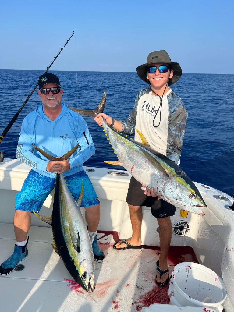
For seasoned anglers, predicting the next big tuna bite is a highly sought-after skill, blending art and science. While traditional tuna fishing methods rely heavily on instinct and experience, technological advancements are revolutionizing the sport. Satellite imaging, often used for weather forecasting or military operations, now provides valuable data that helps pinpoint where tuna and other sought-after pelagic species are likely to feed. By understanding oceanic patterns from space, anglers can increase their chances of landing a prized catch. Technology like Hilton’s Realtime Navigator is useful for targeting any tuna species, whether bluefin, yellowfin, or blackfin. This article explores how satellite data helps predict tuna behavior and the advanced tools anglers can leverage to stay competitive and have a successful day on the water.
How Satellite Data Works for Fishing
Hilton’s Realtime Navigator uses satellites orbiting the Earth to provide real-time insights into offshore conditions. These data streams offer critical information about sea surface temperature (SST), chlorophyll concentrations, and current patterns—all key factors in tracking tuna movement. For fishermen, satellite data allows a deeper understanding of where tuna might gather, saving time, effort, and fuel while increasing the chances of success. Satellites measure these variables using sensors that capture visible light, infrared, and microwave radiation, all providing insights into the dynamic environment that tuna are likely to frequent. By layering this data, anglers can pinpoint fishing “hotspots” based on environmental cues and current satellite measurements.
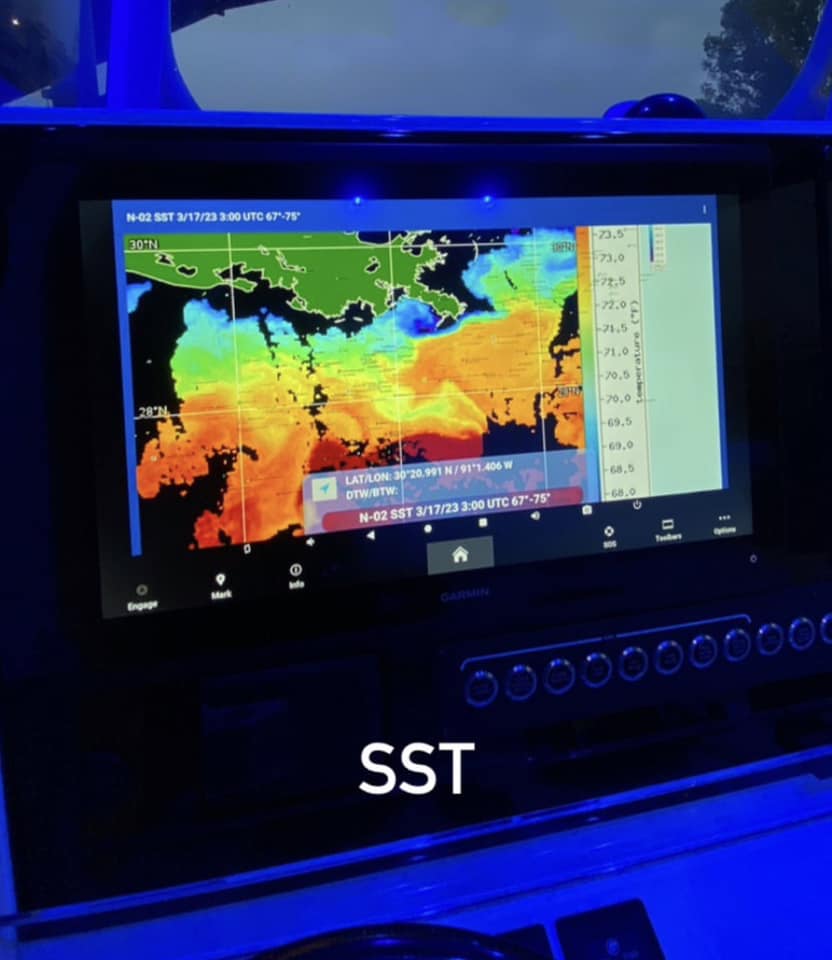
Why Sea Surface Temperature (SST) Matters
Tuna, like most fish, have a preferred temperature range. Sea Surface Temperature, or SST, is crucial because tuna are migratory and often follow temperature breaks in the water, seeking out areas where warmer and cooler waters meet. These zones, called “thermal fronts,” are prime hunting grounds for tuna, as they often attract nutrient-rich upwellings. For instance, bluefin tuna thrive in cooler waters, while yellowfin are commonly found in warmer regions. Satellite data on SST can help anglers identify these transition zones, leading them directly to schools of tuna. Understanding SST patterns can mean the difference between a successful trip and a slow day on the water. Hilton’s Realtime Navigator provides next-level information that can give anglers a competitive edge when planning their tuna expeditions.
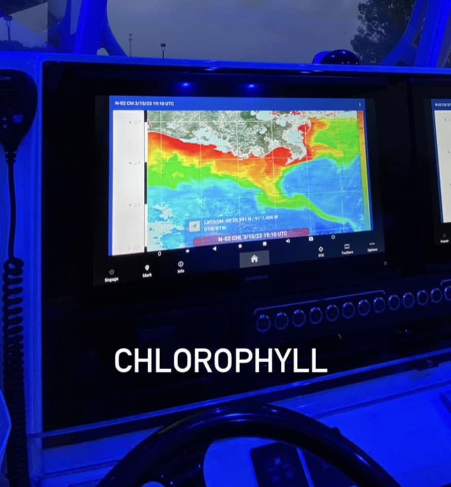
Tuna Movement and Chlorophyll Levels
Chlorophyll concentrations, visible from satellite imagery, are another key factor in locating tuna. Chlorophyll data indicates the presence of phytoplankton, the foundation of the marine food chain. Where phytoplankton blooms, baitfish like sardines and anchovies gather; where baitfish go, tuna often follow. Experienced anglers know that high chlorophyll levels can signal productive fishing areas, while too much chlorophyll may indicate murky waters, which are less favorable for sight predators like tuna. By analyzing chlorophyll levels alongside SST data, fishermen can determine which areas are likely to serve as active feeding grounds for target species.
Current Patterns and Tuna Migration
Ocean currents, both surface and deep, play a pivotal role in tuna migration patterns. Currents transport nutrients, create upwellings, and impact water temperature—all factors that influence tuna behavior. Tuna often ride ocean currents to cover large distances, using these “ocean highways” to search for food. Hilton’s Realtime Navigator monitors current patterns via satellite, helping fishermen anticipate where schools of tuna might move. Understanding how currents interact with SST and chlorophyll levels can provide a strategic advantage; for example, when a nutrient-rich current meets a thermal front, it can create an ideal hunting ground for tuna.
Putting It All Together
When combined, satellite data on SST, chlorophyll levels, and current patterns create a comprehensive view of the ocean’s dynamic environment. Experienced anglers interpret this information to predict where tuna are likely to gather. By aligning satellite data with personal knowledge of local fishing spots and seasonal tuna behavior, anglers can significantly improve their success rates. While each variable is valuable on its own, the real power lies in their combined use. A promising fishing spot may have the right temperature but lack the baitfish that attract tuna. Using SST to locate thermal fronts, chlorophyll data to find feeding grounds, and current patterns to track migration routes enables anglers to target the most productive areas.
Accessible Tools for Anglers
While satellite data might sound complex, tools like Hilton’s Realtime Navigator have made it accessible to anglers. This platform provides real-time information on SST, chlorophyll concentrations, and currents, enabling anglers to make data-driven decisions from their boat or even before leaving the dock. The availability of such platforms has made satellite data a vital tool for any serious angler looking to optimize their fishing efforts.
The Future of Satellite Technology in Fishing
As satellite technology advances, its application in fishing will grow increasingly refined. Emerging technologies, such as AI-driven predictions and more frequent satellite launches, will provide higher-resolution data, making predictions more accurate than ever. Companies like Hilton’s Realtime Navigator will be ready to adapt to these advancements. In the future, we may see predictive models capable of forecasting tuna movements weeks in advance or even identifying the size and type of schools in specific areas. Increased collaboration between scientists, satellite data providers, and the fishing community will drive further innovation, making satellite data an integral part of planning fishing trips, much like modern-day bass fishermen rely on front-facing sonar.
Conclusion
For experienced anglers, using satellite data to predict the tuna bite is a game-changer, offering a competitive edge during tournaments or a leg up over others fishing in the same area. By using Hilton’s Realtime Navigator to understand SST, chlorophyll levels, and current patterns, anglers can anticipate where tuna will feed and maximize their chances of success. With accessible tools and evolving technology, satellite insights are becoming an indispensable part of the modern angler’s tackle box. Next time you plan a tuna expedition, don’t just rely on instinct—look to the skies for an edge on the water.